
From Maps to Mastery: Leveraging Geo-Intelligence and Automation to Optimize Mobile Networks

Mobile operators today are navigating a data tsunami. With the constant flow of network KPIs, subscriber events, call traces, and configuration changes, the sheer volume of information can be overwhelming. What’s even more daunting is turning that data into actionable insights—quickly and accurately.
Traditional troubleshooting methods—sifting through logs, manually reviewing KPI tables, or relying on generic alarm thresholds—are no longer enough. In dense urban environments, complex multi-technology networks, or even rural areas with variable coverage, operators need something more precise, more visual, and far more scalable.
That’s where geo-intelligence and automation come in.
Seeing the Network Through a New Lens
Aircom’s Mentor solution is redefining how operators view and optimize their networks. At its core is a sophisticated geo-location engine capable of mapping subscriber experiences with remarkable accuracy—on roads, in high-rise buildings, through tunnels, and across transport corridors.
But visibility is just the beginning. Mentor doesn’t stop at showing where things happen—it reveals why they’re happening and what to do about it.
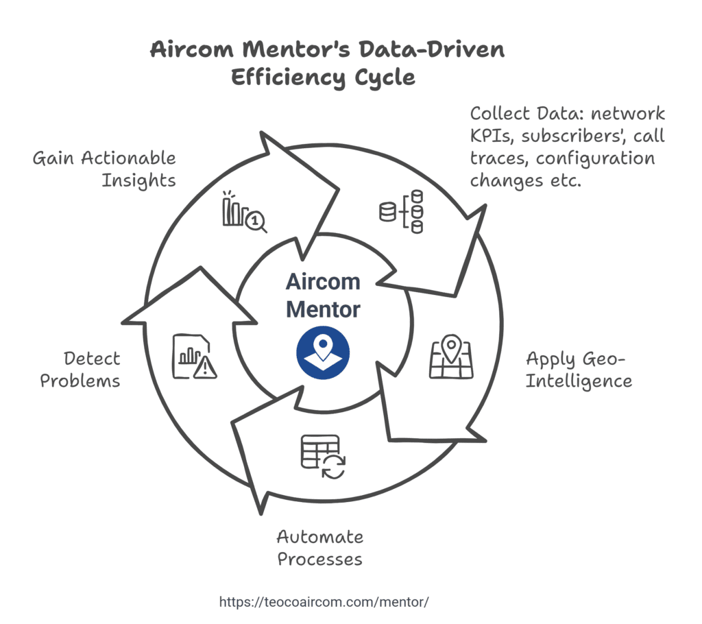
From Raw Data to Real-Time Insight: The Role of Geo-Intelligence in APD
The game-changing component of Mentor is its Automatic Problem Detection (APD) module. While many tools surface performance indicators, APD turns these into geographically clustered problem zones—giving operators the clarity to act. Here’s how it works:
Geo-polygons:
These are created automatically based on traffic or event density.
Custom rules:
These assess KPI abnormalities like drop rates, interference, or data congestion.
Severity levels:
These are assigned to each issue, enabling smart prioritization.
Interactive maps:
These highlight problem areas, from metro tunnels to top floors of skyscrapers.
The result? Engineering teams don’t just see numbers—they see where problems occur, how serious they are, and what’s likely causing them.
The Impact of Geo-Intelligent Automation
By combining powerful visualization with automated diagnostics, APD enables a shift from reactive to proactive operations. No more waiting for complaints or digging through static reports. With Mentor, operators can:
- Resolve issues before they affect subscribers
- Reduce mean time to identify (MTTI) and mean time to resolve (MTTR)
- Focus resources on the most impactful problems
- Plan upgrades and expansions based on actual usage and experience
It’s not just troubleshooting—it’s network mastery.
From Blind Spots to Better Experiences
The ultimate goal is to ensure every subscriber has a reliable, high-quality mobile experience—whether they’re streaming from their couch, navigating city traffic, or taking an underground train.
With Mentor and APD, operators don’t just manage data—they unlock its value. They gain a clear, location-aware understanding of their network’s health, enabling faster decisions, optimized performance, and improved customer satisfaction.
In a data-heavy world, Mentor is how operators move from maps to mastery.
How can we help?
For over 30 years, Aircom has helped network operators run state-of-the-art mobile networks and profitable businesses. Learn how we can help you in the areas critical to the success of modern CSPs.