
From Cities to Stadiums: The Growing Need for Location-Aware 5G Planning

As 5G networks expand across the globe, the need for intelligent, location-aware radio planning has never been greater. Operators are discovering that delivering reliable 5G coverage isn’t just about population density or spectrum availability—it’s about understanding exactly where, when, and how users connect.
In today’s mobile environment, a one-size-fits-all approach to network design doesn’t work. 5G planning must adapt to specific places, user behaviors, and usage patterns, whether in urban pockets, high-rise buildings, shopping malls, transport hubs, or massive sports arenas.
Why Location Matters More in 5G
Previous generations of mobile technology, particularly 3G and early LTE, were mostly built with macrocell coverage in mind. Operators could meet service requirements using broad assumptions about where people lived and worked. But 5G changes that. Here’s why:
Higher frequencies, lower reach
5G uses mid-band and mmWave spectrum that can’t travel far and is easily obstructed. Planning must account for obstructions like buildings, glass, foliage, and even crowds of people. Knowing exactly where signal loss occurs is critical.
Indoor vs outdoor usage
A large portion of 5G data usage happens indoors. Whether it’s a hotel lobby, airport terminal, or underground metro station, location-specific planning ensures that signal strength and capacity match real-world usage environments.
Traffic isn’t uniform
Data consumption isn’t evenly spread. In reality, certain zones generate disproportionate demand, such as city centers during office hours, stadiums on match days, and residential clusters during peak streaming times. Without precise, location-based planning, these zones become performance bottlenecks.
Vertical demand is real
Urban density isn’t just horizontal, it’s vertical. High-rise buildings, multilevel malls, and elevated roads demand planning across different height layers. This adds a new dimension (literally) to planning complexity.
From Population Heatmaps to Geo-Intelligent Design
To solve these challenges, operators are embracing geo-intelligence, which is the ability to incorporate precise location data into network planning decisions. This includes:
- Crowdsourced and geolocated usage data: Heatmaps based on actual user location and traffic consumption give planners visibility into true demand areas.
- 3D building data and elevation models: These improve accuracy for signal propagation at various heights, especially in mmWave and indoor deployments.
- Time-based analytics: Demand can shift drastically throughout the day. Knowing when a particular zone peaks allows for time-aware optimization.
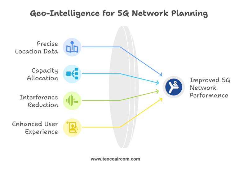
This move from traditional map-based planning to location-aware, data-driven design leads to better capacity allocation, reduced interference, and improved end-user experience, particularly in complex areas like stadiums, transit hubs, and smart campuses.
Where ASSET Fits In
To make this approach scalable and efficient, operators need a planning platform built around spatial intelligence—and this is where Aircom’s ASSET Suite comes in.
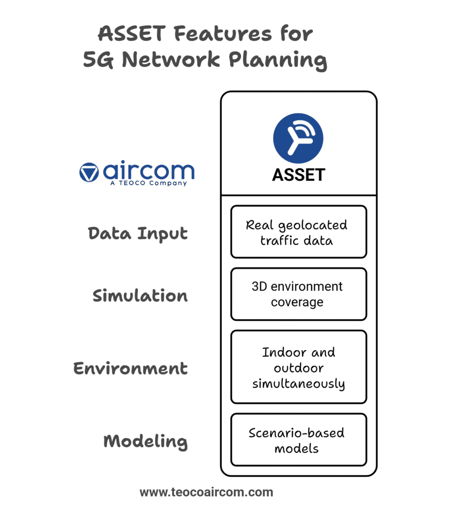
- Use real geolocated traffic data (from probes, drive tests, or third-party sources) to inform design decisions.
- Simulate coverage in 3D environments, accounting for signal propagation across different heights and building types.
- Plan for indoor and outdoor environments simultaneously, including public venues, enterprise buildings, and mixed-use complexes.
- Run scenario-based models to test how coverage, capacity, and interference respond to changing user density or physical obstructions.
With integrated modules like ASSET Geo, planners can visualize subscriber behavior, model indoor loss accurately, and simulate “what-if” traffic scenarios—all within the same environment.
Planning in the Real World
Location-aware planning isn’t just a technical upgrade, it’s a strategic requirement. Operators that ignore these spatial realities risk overbuilding in low-use areas, under-delivering in hotspots, and ultimately wasting precious spectrum and CapEx.
Whether you’re rolling out 5G in a dense megacity, managing peak demand at an international airport, or launching private networks on a university campus, where you plan is just as important as how you plan.
What’s Next?
As 5G evolves toward fixed wireless access (FWA), private networks, and 6G-readiness, location-aware intelligence will be foundational. The networks of tomorrow will not only be faster—they’ll be smarter, spatially optimized, and deeply aligned with real-world user needs.
Explore more insights on 5G planning, AI-driven automation, and advanced modeling in our blog series here.
How can we help?
For over 30 years, Aircom has helped network operators run state-of-the-art mobile networks and profitable businesses. Learn how we can help you in the areas critical to the success of modern CSPs.